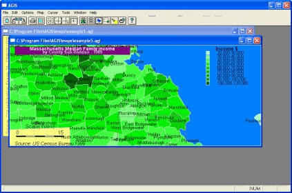
No specific info about version 2.0. Please visit the main page of AGIS on Software Informer.
Visualizes your tracks on Google Maps showing coordinates like latitude.
Tool to quickly visualize the GPS location of a photo.
Add geotagging information to your photos.
It calculates the location of almost any type of locator.
This program displays digital images and GPS Tags.


Comments